Visual Anthologies
Situated at the southern terminus of the Salish Sea, Thurston County offers a visual duality: the structured rigidity of the Capitol Campus and the fluid dynamics of the Nisqually Delta.
For the client, this is your menu. For the scout, this is the map. We analyze the quality of light, architectural provenance, and logistical realities to ensure your session isn't just a photo shoot—it's a production.
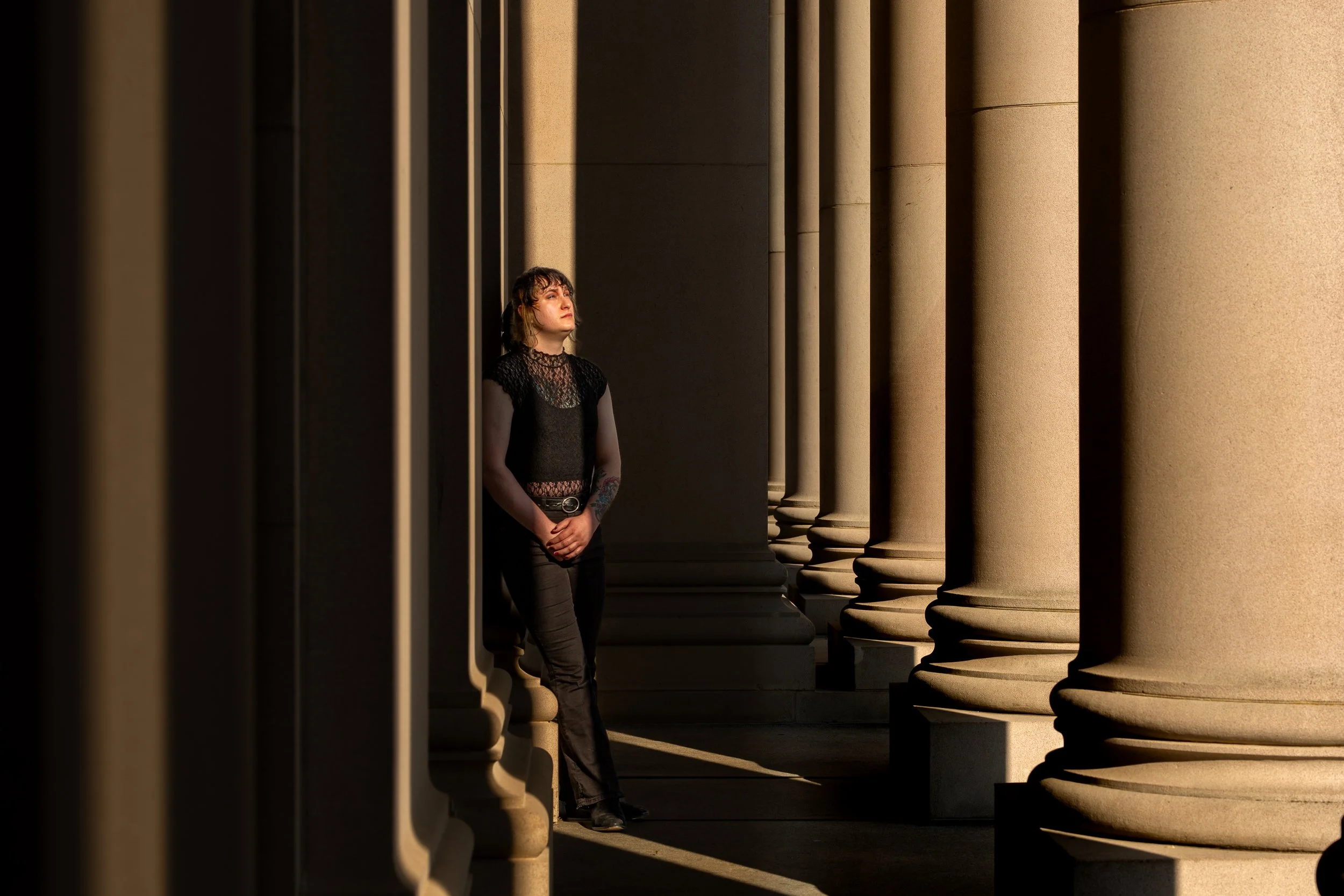
The Capitol
Neoclassical grandeur defined by Wilkeson sandstone. The honey-colored stone absorbs light, creating a "giant softbox" effect under overcast skies. Features the North Steps for drama and the Cherry Blossom Circle (Mar/Apr) for color.
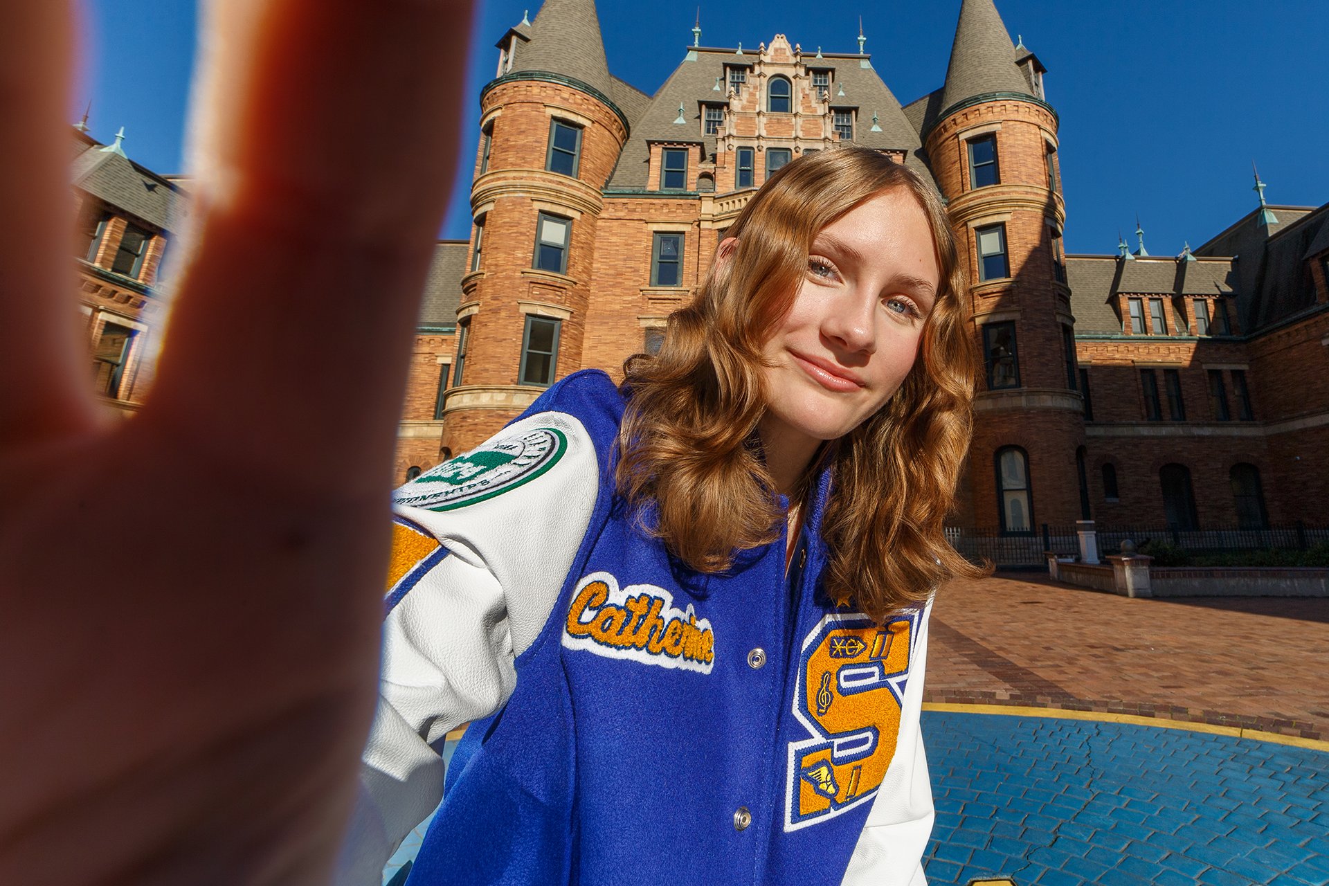
The Castle
Romanesque Revival architecture meets the deep blue of Commencement Bay. The "Bowl" offers sweeping water views while the brick archways provide historical texture. Best for high-impact commercial looks.
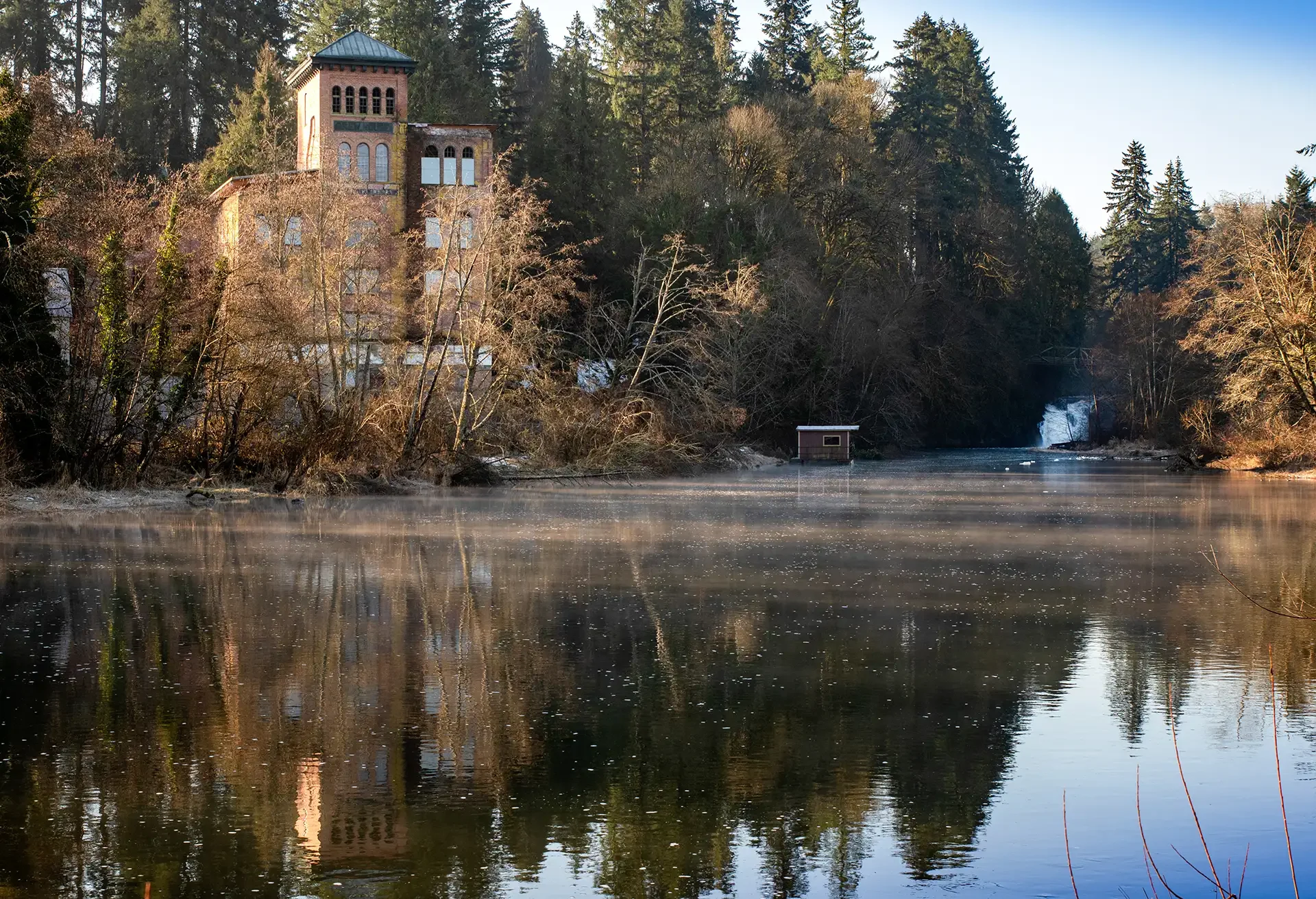
The Brewhouse
Industrial Gothic. The red brick of the 1906 Old Brewhouse contrasts vividly with the green river valley. Best photographed in late afternoon when western sun illuminates the masonry texture.
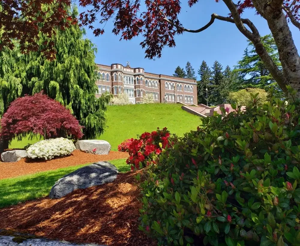
The Abbey
Old Main's grand staircase offers imposing academic weight. The Abbey grounds are contemplative and secluded, perfect for formal portraits requiring a sense of history.

The Coast
Driftwood, mist, and the raw Pacific edge. Located at Ruby Beach or Kalaloch. A high-effort sector for those seeking a cinematic "mood" aesthetic unmatched by the inland sound.
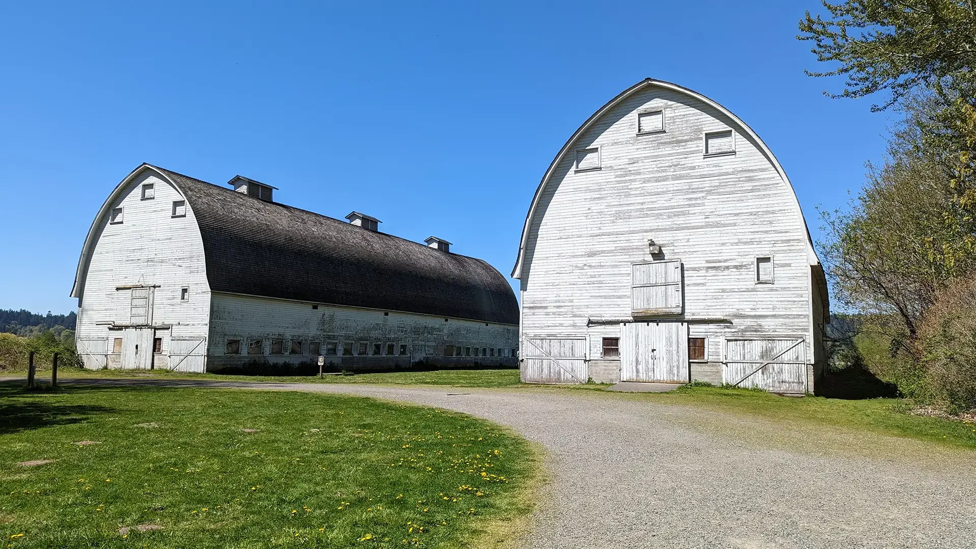
The Delta
Billy Frank Jr. Refuge. The Twin Barns Boardwalk offers long sightlines and tall grasses. Best at Golden Hour. Note: Strict no-drone policy and "Leave No Trace" enforcement.
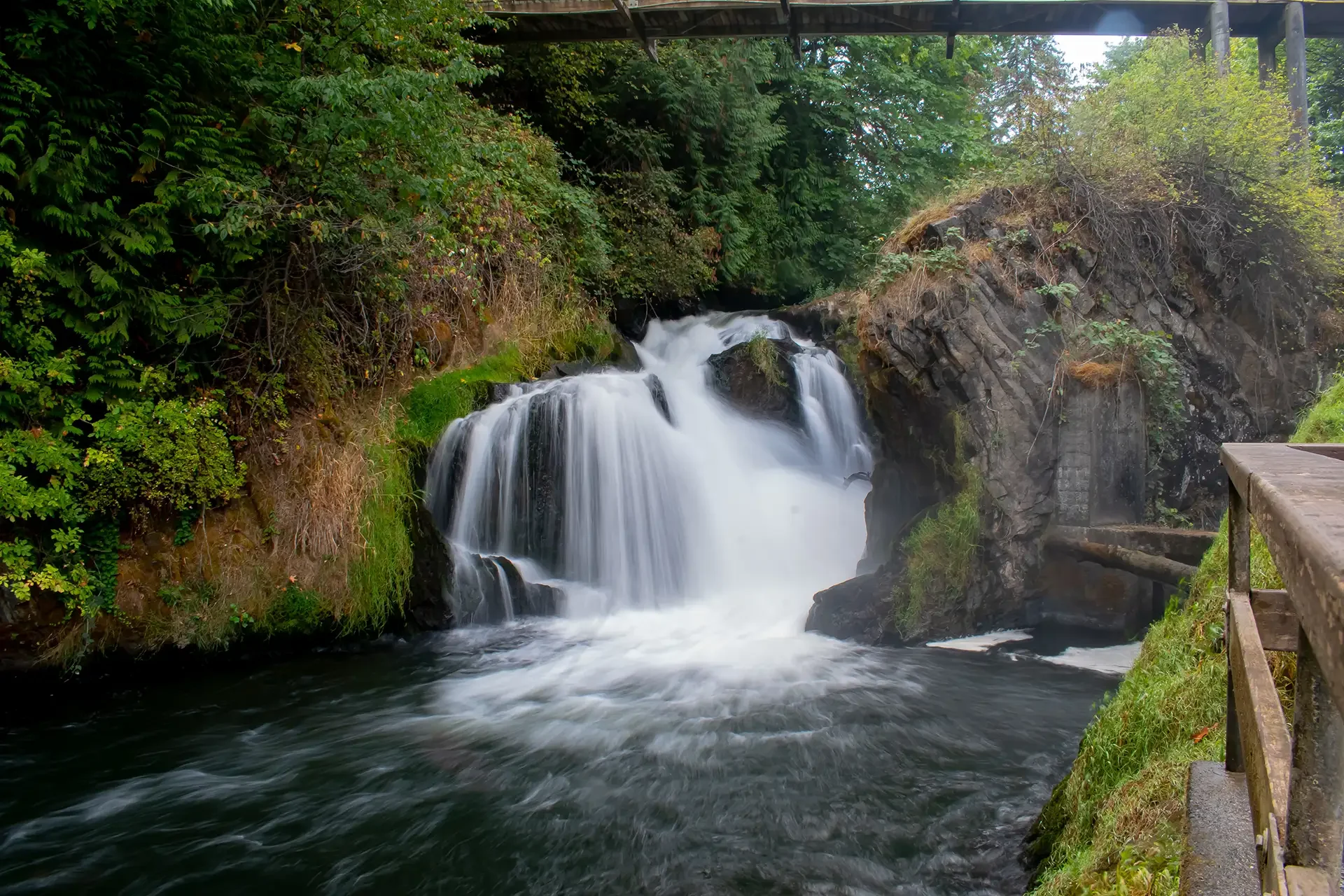
The Falls
A clash of natural force and industry. The river drops 82 feet, creating mist and deep canyon shadows. Overcast days are required to manage the high dynamic range of the white water.
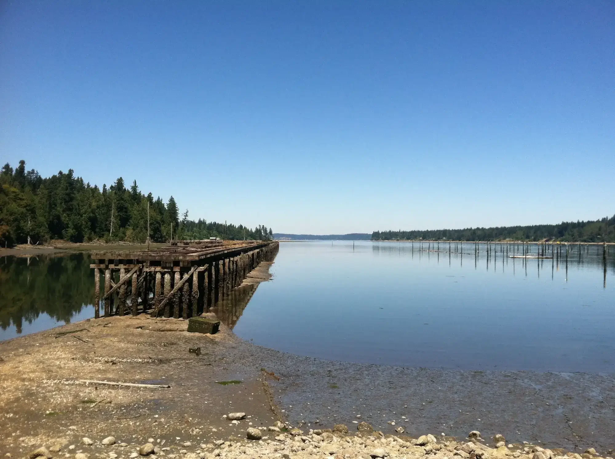
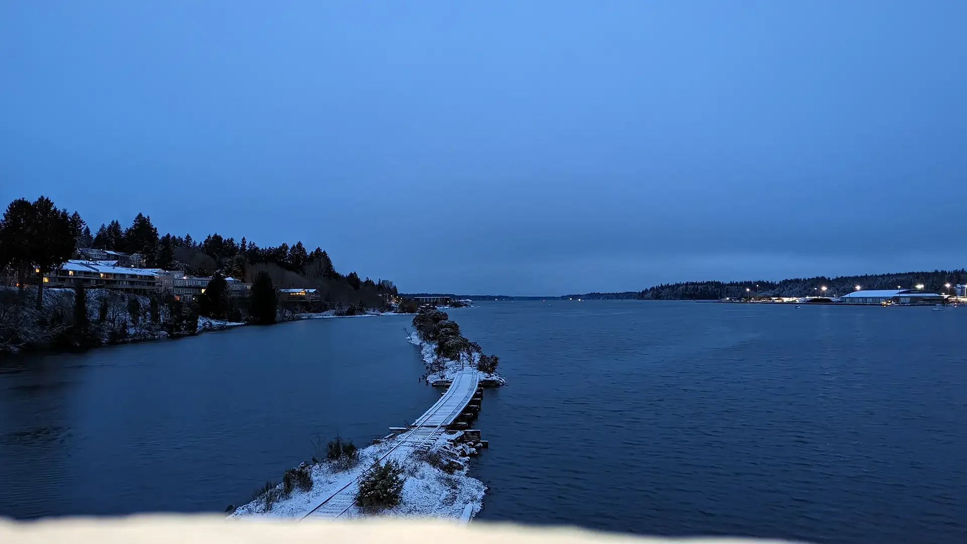
The Trestle
Woodard Bay Conservation Area. The rotting pilings of the Weyerhaeuser trestle stretch into the bay, offering a textured, moody backdrop rich in industrial decay and forest canopy.
The Rails
Located under the 5th Avenue Bridge. Abandoned railroad tracks painted in a spectrum of colors. Powerful leading lines and industrial contrast against the dark overpass.
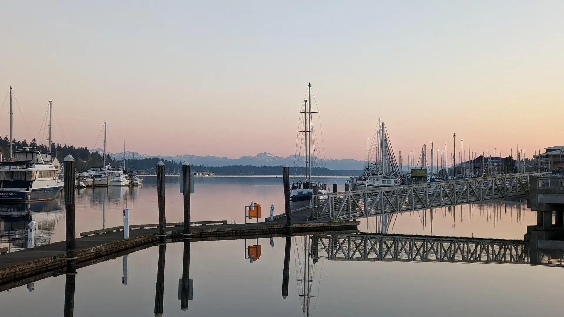
The Landing
The heart of the waterfront. Geometric chaos of sailboat masts meets the wooden boardwalk. West-facing for perfect sunset silhouettes and "golden hour" warmth.
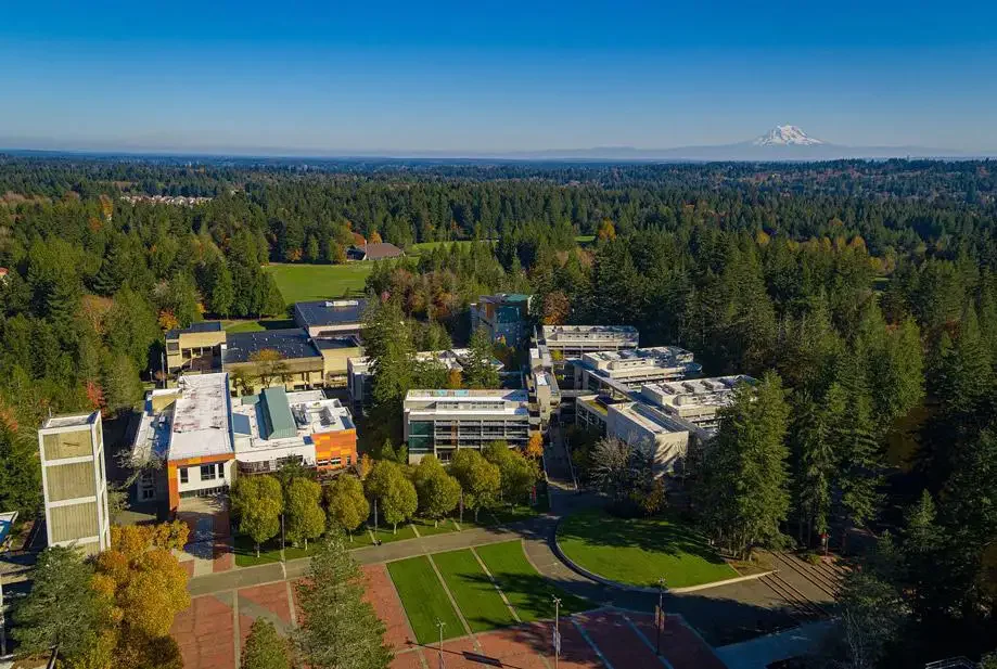
The Brutalist
Evergreen State College. Harsh lines, geometric shadows, and raw concrete textures. Excellent for high-fashion shoots where the grey texture makes colorful clothing pop.
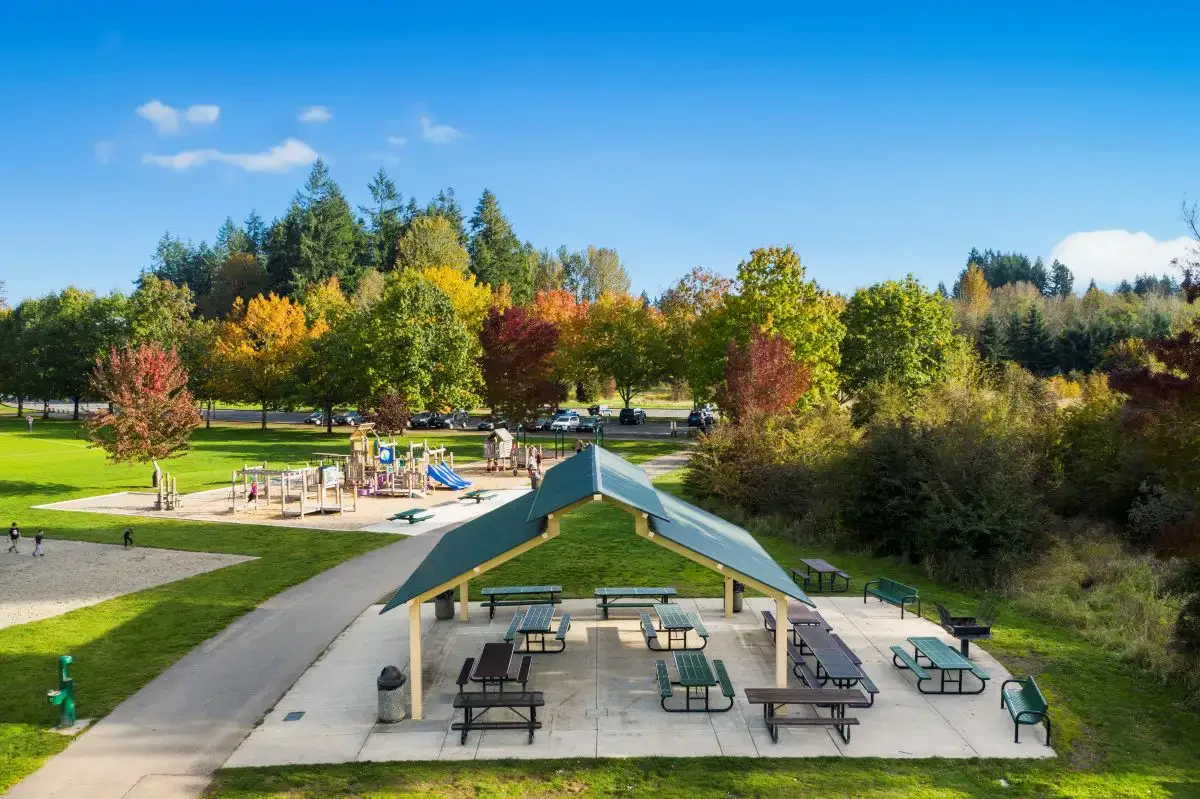
The Concrete
Sehmel Homestead Park. Expansive turf fields bordered by deep evergreen woods and winding trails. A versatile sector offering both athletic clarity and forest density.
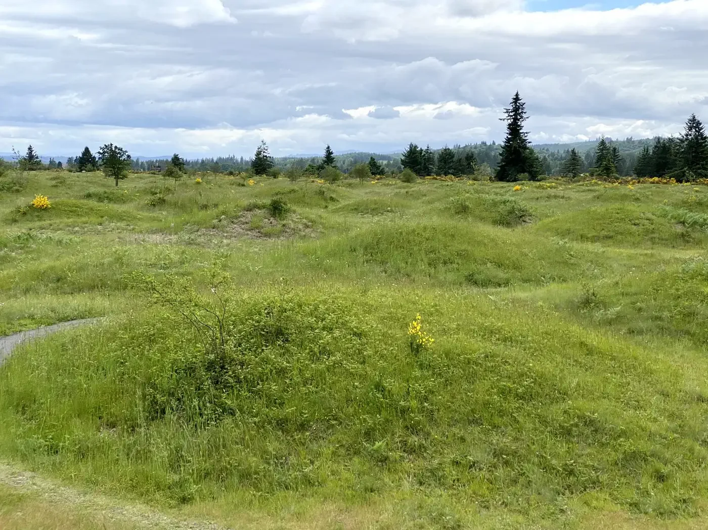
The Mounds
A geological enigma. Hundreds of uniform grassy mounds create a rhythmic pattern. Best at sunrise/sunset when low light casts long shadows that accentuate the topography.
The Fields
Pioneer Park. Famous for its tall grasses that catch the golden evening light perfectly. The pastoral setting allows for backlighting subjects without obstruction.
Permits & Passes
State Parks and DNR lands (Mounds, Woodard Bay) require a Discover Pass ($30/yr). Nisqually requires a Federal Pass ($3 daily).
Tide Intel
High Tide: Required for reflections at Nisqually and Percival Landing.
Low Tide: Essential for beach exploration at Squaxin Park.
Weather Intel
Olympia is a giant softbox. Our overcast skies diffuse light perfectly for skin tones. Don't fear the grey; it's our studio lighting.
Leave No Trace
We protect the sector. No trampling wildflowers (Camas at Mima Mounds). We stay on designated trails to protect sensitive habitats.

Signal Intelligence
The map is not the territory. I am always scouting for the next sector—whether it's a hidden alley, a safe haven for queer joy, or a rooftop with a view.
If you know a spot that fits the narrative—or breaks it entirely—transmit the coordinates. The map is open.